Search This Blog

Showing posts with label Hikes Lanzarote. Show all posts

Wednesday, December 21, 2016

2016 Hike Lanzarote Haria to Mirador del Risco de Famara

1100hrs Wednesday 7/12/16 we drove from Arrecife Marina to the picturesque town of Teguise 
 
Teguise
 

where we visited the Aloe Museum
 

 where we learned amongst other things, about the Cochineal Insect which feeds on the cacti and is crushed to produce a crimsom substance used for food colouring and dyes.
 
The female Cochineal insect attaches itself to the cactus and sucks out the juices from cactus. The nymphs she produces cover themselves with a white substance living with their mother on the cactus until they are mature. They are harvested for dye production by simply scraping them off the cactus.

 
Then we drove towards Haria, stopping at the restuarant car park of the Mirador los Helechos
 
From the Mirador los Helechos one has superb views of the NE coast of Lanzarote with the coastal towns of Arrieta and Punta Mujeres clearly visible
 
One also has a very good view of Haria
 
We parked close to the center of Haria and walked to the Mirador on top of the cliffs  with superb views of the  NWest coast
 
To the north, the island of Graciosa was clearly visible
 
We then followed the track which skirted southwards around Montana Ganada
 
Eventually climbing back up to the clifftop through a picnic area to the Mirador de Risco de Famara, again with superb views of the coast below


The below Viewranger app map shows the track we actually walked from/ to Haria plus the car route to the Mirador los Helechos
 

Monday, December 19, 2016

2016 Hike Lanzarote Caldera Blanca Rother's nr 19

Tuesday 6/12/16 drove with our Orlando rental car via Mancha Blanca down a rough track to the carpark at the start of our hike to and clockwise around the rim of the Caldera Blanca - Rother's Walking Guide nr19.
 
Our track is recorded in the below Viewranger map 
 
We started walking at 1105hrs. The first part of the route was over a very rough track through the lava flows - quite uncomfortble on the feet.
 
Our first view into the crater after the steep climb to its rim
 
Our position when we took the above photo is shown by the red circle on the below Viewranger map


Since arriving on the island, we have been surprised at how green parts of the island are - we remember Lanzarote as being a very brown barren island.


The highest point of the rim - Montana Blanca, around 461 meters
 
Below one can see how the lava flowed around volcanoes from previous eruptions
 
After scrambling up a steep section of the rim, we were met by these mountain goats.
The official walking route descends before reaching this part of the ridge. We decided we preferred to complete the circumnavigation of the rim
 
The below Viewranger map shows our position where the above photo was taken. The stippled track to the left is the official route


The track on the rim of the caldera is a bit like a knife edge here - probably why the official route avoids it by descending and contouring around the outer base of the caldera - however, it is the most exciting part of the route!
 
View across the Caldera to Montana Blanca
 
After dscending from the rim, our track rejoined the track we had used initially to take us back through the lava flows to the car. 1555hrs we were back at the carpark - a very enjoyable hike.
 

Saturday, September 8, 2012

Hike Sao Miguel, Sete Cidades PR4SMI & PR3SMI 27 August 2012

Caught the 0825hrs bus from Ponta Delgada to the western caldera of Sete Cidades on Monday 27th August. The weather forecast was for a warm sunny day.
 
Around 0930hrs, got off the bus at the bend above the village where there is a link track to the PR 4 SMI walking trail which follows the farm track along the top of the northern crater rim

Jeannette was in Holland so I did this hike on my own - somewhat risky as last time I hiked alone (Madeira 2010) I walked too fast downhill and had a knee problem for several months.
After a few minutes walk the track passes the junction with the route down to the village of Sete Cidades
 The track passes through a forest of  Cryptomeria Japonica
 After 20 minutes one gets one's first view of the crater lake, the abundant Ginger lilies, Hedychium Gardnerianum in the foreground


 Cows even on the crater rim

 Several Milhafre (Buteo Buteo Rothschildi or Goshawk in English) were seen hovering effortlessly above. Some historians consider the island group is named after this bird which is also known as Acor in Portuguese and is very commonly seen on the islands here and is to be seen on the Azorian Flag.


 A misty view of the north to the east of the north coast
 A concrete track leads steeply down towards the eastern end of the trail
 As there is no official connection between the PR4SMI (northern crater rim trail) & PR3SMI (southern crater rim trail), one needs to find a way to get to the other side of this ravine. Last time we did this hike in October 2011 we had difficulty finding a link path

Others had obviously had this in mind and a path appeared over the low concrete curb
 which kept close to the hydrangea hedge between the field and the top of the cliff

 and a break in the opposite vegetation
 gave access to the red basalt tracks in the Cryptomeria Japonica forest. Last time we did the hike, we were very fortunate and some kind people gave us a lift in their car to the start of PR3SMI - this time no such luck so had to walk about 4 kms along the main road to the start.


 The forest track emerged at the car park for the PRC5SMI trail. Here one turns right following the road towards Sete Cidade
 A short detour following the road to the left gives one a view of the old Aquaduct


 After 20 minutes along the road, one gets one's first view of the Sete Cidades lake
 and the junction with the road to the village of Sete Cidades. We continue to Vista do Rei

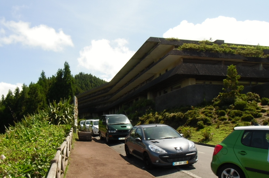
 The abandoned hotel at Vista do Rei , 45 minutes walk from the PRC5SMI car park

The information board for the PR3SMI route along the southern crater rim - the second half of the hike
 PR3SMI route


 The junction with the PR25SMI trail to Ginette which we did 7 October 2011
 15.10hrs arrived at the end of the hike just a 100 meters south of the place where I started the hike. Here I waited for the 16.25 bus from Setes Cidades (bus was about 25 minutes late)
See link below for the previous time we did this hike