Search This Blog

Showing posts with label Nature. Show all posts

Friday, June 3, 2011

Portuguese Man o War 3 June 2011

One of the delights of anchoring compared to being in a marina is that we swim most days from the boat. Most of the time, there is nothing around to bother one, however, from time to time we see a few Portuguese Men o War sailing past.
As the sting from their many meters long tentacles can be quite severe, we keep a close lookout when swimming.
These photos were taken today of one of them which sailed a few meters from Dutch Link.
The first time we encountered a lot of these animals was in Bermuda, then on Miami Beach and in the Bahamas. We also saw many in the seas around the Azores.

Wikipedia has this to say about them:-

quote:
The Portuguese Man o' War (Physalia physalis), also known as the Portuguese man-of-war, man-of-war, or bluebottle, is a jelly-like marine invertebrate of the family Physaliidae. The name "man-of-war" is borrowed from the man-of-war, a 16th century English armed sailing ship.
Despite its outward appearance, the Man o' War is not a true jellyfish but a siphonophore, which differ from jellyfish in that they are not actually a single creature, but a colonial organism made up of many minute individuals called zooids.[1] Each of these zooids is highly-specialized and, although structurally similar to other solitary animals, are attached to each other and physiologically integrated to the extent that they are incapable of independent survival.
The Man o' War is found in warm water seas floating on the surface of open ocean, its air bladder keeping it afloat and acting as a sail while the rest of the organism hangs below the surface. It has no means of self-propulsion and is entirely dependent on winds, currents, and tides. It is most common in the tropical and subtropical regions of the Pacific and Indian oceans, but can drift outside of this range on warm currents such as the Atlantic Gulf Stream. unquote


Cicada 31 May 2011

Whilst lying at anchor, just after it became dark, we heard an insistant sound outside. Went on deck to investigate - nothing to be seen. At first we thought it was a seabird but as the high pitched sound was so continuous, came to the conclusion that it was more likely to be an insect.
After wandering up and down the deck a few times, finally located this 5 cm long cicada type insect under the teak grating on the cockpit floor. Hit it with a walking stick and gave it to the fish - peace returned on Dutch Link.

Thursday, May 19, 2011

Hike La Gomera from Pajarito to Hermigua 5 May 2011

5 May we took the Nr 1 Bus from San Sebastian to Pajarito close to the 1487 peak of Mt Garajonay, the highest peak on La Gomera, in the Garajonay National Park. From here we hiked to Hermigua following route 49 in Rother's Walking Guide.
The first part of this, the most well know of the island's many hiking trails, is through the ancient Laurisilva Bosque del Cedro. This wood consists mainly of evergreen Laurel and Heather Trees.

We stopped for a picnic lunch close to the Ermita de Lourdes where a hungry Chaffinch dropped in to join us

Please Click on arrow to start video clip

Closeby a tree provided a constant stream of water - so cleverly engineered that we were not able to work out the source of the flow.

Many wild flowers en route

This is one of the few places on the island where streams flow all year round.

From time to time one had views of neighbouring Tenerife.
Emerging from the forest Hermigua, our destination came into view way down the much terraced valley, some 550 meters below.
The path for this final part of the walk consists of hundreds of meters of steep rock steps - very hard on the knees !

From time to time one had views of a very long waterfall.

Then the first of the Twin Crags, Los Gemelos, come into view as one nears Hermigua
Irrigation pipes follow the route to the fertile valley.

Once in Hermigua we took the Nr 2 bus back from Hermigua to San Sebastian

Saturday, November 6, 2010

Sail La Gomera to La Palma ? 6 November 2010

At 0700 hrs just after daybreak we slipped our mooring and headed for the most NWerly Canaries island of La Palma


We had about 12 knots wind in the Acceleration zone which soon dropped to about 6 knots true as we rounded the NE point of La Gomera. However, the forecast easterly wind did not materialise and we were motoring in a light head wind. The route took us just a few miles off the quite spectacular north coast of La Gomera, passing the picturesque town of Agulo, perched on a sort of plateau with towering cliffs behind it.


Soon afterwards, Jeannette happened to look up at the mainsail and found that the stitching between two panels had broken. Checked in our pilot books to find that there is no sailmaker on La Palma. So after contacting the San Sebastian Marina to see if our berth was still free and ringing the sailmaker to make a reservation for repair to the mainsail for Monday Morning, we made a 180 degree course change and headed back to San Sebastian.

Soon after turning back, the clutch on the fishing reel started to slip and, yes we had hooked a smallish Mahi Mahi.
Small but big enough to eat this evening.

Re-entered the by now familiar yacht channel


and remoored in our old berth in San Sebastian, La Gomera.

These two pictures show the 3 ferries all of which make 3 trips a day between Los Cristianos and San Sebastian, two of them car ferries and the mall one just passengers. They also call at La Palma and El Hierro.


So back to enjoying our daily swim from one or other of the two beaches either side of the marina until the sail is repaired. Below is the calm beach within the outer harbour mole

Below is the more exciting beach just north of the marina which frequently has heavy surf.

Saturday, October 23, 2010

Fuerteventura Puerto Castilo and trip around middle of Fuerteventura, 16 to 20 October 2010


Spent several days in Puerto Castillo, snorkelling every day from the stern of the boat to the rocky harbour mole where we saw many fish of different sizes.


Rented a car to explore the central part of the island of Fuerteventure, stopping first at the old capital, Antigua which was first settled in 1485. Below is the 18h century church of Nuestra Senora de Antigua.
Then on to the picturesque town of Betancuria nestled between the volcanic peaks, founded in 1404.


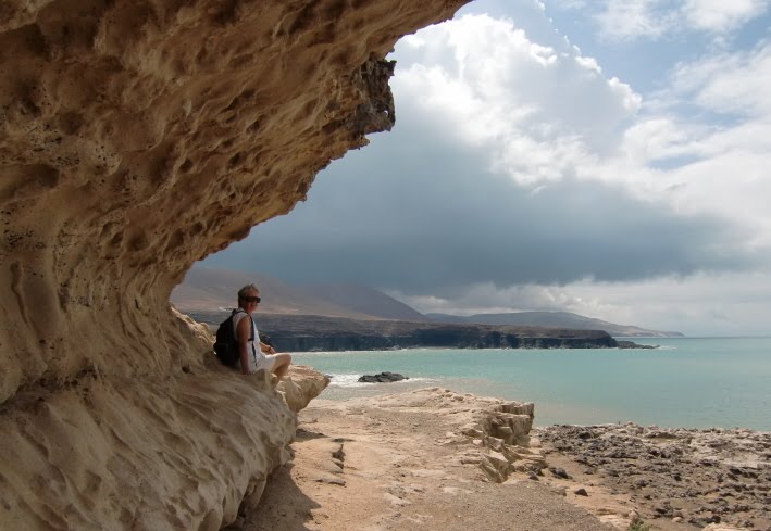
Stopped for lunch at the old fishing port of Anju on the west coast for lunch. Had a stroll along the heavily eroded coast with its many shallow caves.


Stopped at an Aloe Vera processing factory.
There are around 250 different species of Aloe Vera of which only a few are suitable for the body lotions. The species used here are best for harvesting when they turn pinkish.
One of the staff kindly showed us which part of the plant is used for the lotions - namely the transparent coulourless inside of the 'leaves'.


Stopped at an viewing point along the road and were fortunate to see Chipmunks - the last time we had seen them was on Cape Breton Island in Nova Scotia.
Most of the time we were driving through desert-like landscapes with the road twisting its way between the volcanic peaks.
The furthest south we reached was the area of sandy beaches called Costa Calma - very long golden sand beaches with sand dunes behind them - the whole coastline covered by huge resort hotels.
Normally there is a lot of wind here as can be evidenced by the large wind generator park and wind surfing championships are held in this area. However, when we were there there was hardly any wind.
Although at first sight everything looks barren, there is some agriculture - raising herds of goats
and in several areas we saw fields covered with a type of canvas where tomatoes and other crops are grown
Close to the marina of El Castillo there is an old sea salt producing area

Stopped at Pozo Negro - a possible anchorage in calm conditions