Around 0930 on 27 May we set off on the hike from Valle Gran Rey to to small town of Arure - walk 31 in Rother's Walking Guide.
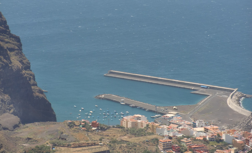
 The walk started from the picturesque hillside residential area of Calera at the western end of Valle Gran Rey.
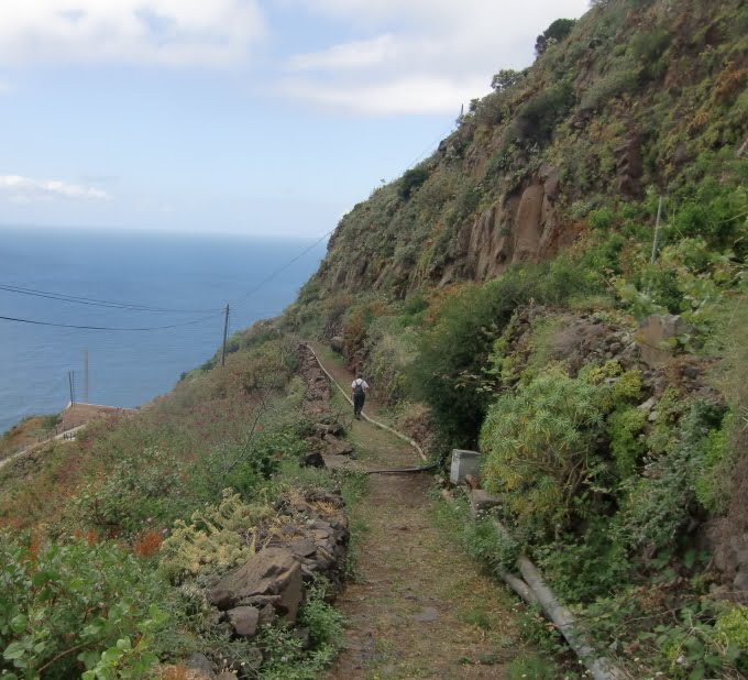
 From here the track climbs steeply in countless zig-zags up the steep cliff with continuous spectacular views of Valle Gran Rey


 Stopped for a picnic at a ledge at 550m above sealevel with magnificent views.
 Heard the tinkle of a goat bell - took a while to locate the owner!


 At the highest point of the hike, La Merica, 857 meters above sealevel, J has a yoga session


 After several hours our objective, Arure comes into view
 Looking back, Valle Gran Rey is just visible between the hills
 10x zoom helps!


 Close to Arure is the Mirador del Santo, built against the cliffside

 All in all a superb hike. Plan was to take the bus back to Valle Gran Rey. However, the bus did not stop for us and we were faced with several hours wait for the next bus. A kind Spanish couple from the neighbouring island of Tenerife took pity on us and kindly drove us back to the boat.
 The walk started from the picturesque hillside residential area of Calera at the western end of Valle Gran Rey.
 From here the track climbs steeply in countless zig-zags up the steep cliff with continuous spectacular views of Valle Gran Rey


 Stopped for a picnic at a ledge at 550m above sealevel with magnificent views.
 Heard the tinkle of a goat bell - took a while to locate the owner!


 At the highest point of the hike, La Merica, 857 meters above sealevel, J has a yoga session


 After several hours our objective, Arure comes into view
 Looking back, Valle Gran Rey is just visible between the hills
 10x zoom helps!

 Close to Arure is the Mirador del Santo, built against the cliffside
 All in all a superb hike. Plan was to take the bus back to Valle Gran Rey. However, the bus did not stop for us and we were faced with several hours wait for the next bus. A kind Spanish couple from the neighbouring island of Tenerife took pity on us and kindly drove us back to the boat.


