With Hurricane Nadine reforming and predicted to go first south and west but later to head back north and hit the Azores for a second time in a week or so time , we decided it would be a good idea to leave Horta on Faial and head east direction Madeira.

The Grib Files indicated that 25th September would be an excellent time to leave Horta as we would then be able to sail on a fine to beam reach the whole way. We really would have preferred to stay a few days in Ponta Delgada to say goodbye to our friends there but the forecast indicated that the high pressure area to the north west of the Azores would drift eastwards giving easterlies over the western Azores making sailing SE rather too close to the wind.
So we hastily converted Dutch Link from Marina to sailing mode, removed the many mooring lines and at 1500hrs 25 September left Horta
The Grib File prediction for the 1500hrs 25 September, the time we left Horta

Leaving Horta in a NE 4 Bft wind with 2 reefs in mainsail and a partially furled Genoa

Initially the wind was a pleasant 13 knots from the NE allowing us to sail on almost a beam reach

Approaching a cloud covered Pico

Passing the southern coast of Pico


Looking back at the peak of Pico just appearing out of the cloud

Sunset


We were lucky enough to be sailing a few days before full moon so we were sailing in a super silvery light

The south coast of Sao Miguel

We had planned on downloading grib files en route via our Iridium phone - however, there was a problem with our system so we could not download them. The thought of making this trip without updated grib files with Nadine lurking close by nearly caused us to stop at Ponta Delgada which our course took us close to. However, a phone call to Carlos in the Ponta Delgada Marina Office solved the problem as he confirmed that Nadine was keeping to its previously forecast track and that the winds for the next few days on our track would stay in the NNE/NE. So we continued on our way to Madeira.

Another lovely sunset

After coming out of the lee of Sao Miguel, the seas became quite rough, (rougher than would be normal for the wind strength) and as we were staying high so as to have a better angle to the wind as we approached Madeira, the boat movement was quite unpleasant with waves breaking frequently over the deck and spray even sometimes coming into the cockpit

At around 0400 hrs 27 September we were well clear of the rocky reefs of the Formigas islands and decided we could free off and set a course for Madeira.
The actual conditions luckily agreed with those forecast in the grib files which we had downloaded before leaving


Despite the water temperature rising to a pleasant 25 degrees C, the force 4 to 6 Bft N/NNE wind had quite a chill and we were dressed accordingly

Although we could not download gribfiles, our trusty Satcom-C system gave us 6 hourly updates on the position and predicted track of Nadine

and a brief summary forecast of the wind strength and direction for the sea areas we passed throuh

The actual conditions continued to agree with those forecast in the grib files which we had downloaded before leaving

For the last two days of the trip we encountered small rain squalls which were clearly visible for some time before they hit us

Typically as a squall approached, the wind would increase from around 15 to 20 to 25 knots then we would be headed as the wind dropped to below 10 knots. After a few minutes the wind would then return to its previous N/NNE direction and strength

Friendly looking puffy clouds

another rain squall approaching


Another moonlit night

getting close - just 17.6 miles to go and still making over 6 knots

Madeira in view

getting closer


Ponta Parga Light house - the most westerly point of Madeira

the coast of Madeira close to Paul do Mar


Paul do Mar

Calhete


Lining up to enter Calhete Marina

Charlet showing narrow entrance to Calhete Marina


Dutch Link Safely moored in Calhete, SW coast of Madeira at 1045hrs UTC 30 September 2012

Total Distance sailed from Horta to Calhete 670 nautical miles
in 4 days 20 hours,
average speed 5.8 knots,
motored 7 hours (mainly in the lees of Pico, Sao Miguel and Madeira)
For the whole trip we had 2 reefs in the mainsail and varying amounts of furling in the Genoa.
The wind varied direction only from NE to North, except in the brief rain squalls with a strength of 4 to 6 Bft with maximum gusts around 25 knots
For the whole trip we had 2 reefs in the mainsail and varying amounts of furling in the Genoa.
The wind varied direction only from NE to North, except in the brief rain squalls with a strength of 4 to 6 Bft with maximum gusts around 25 knots


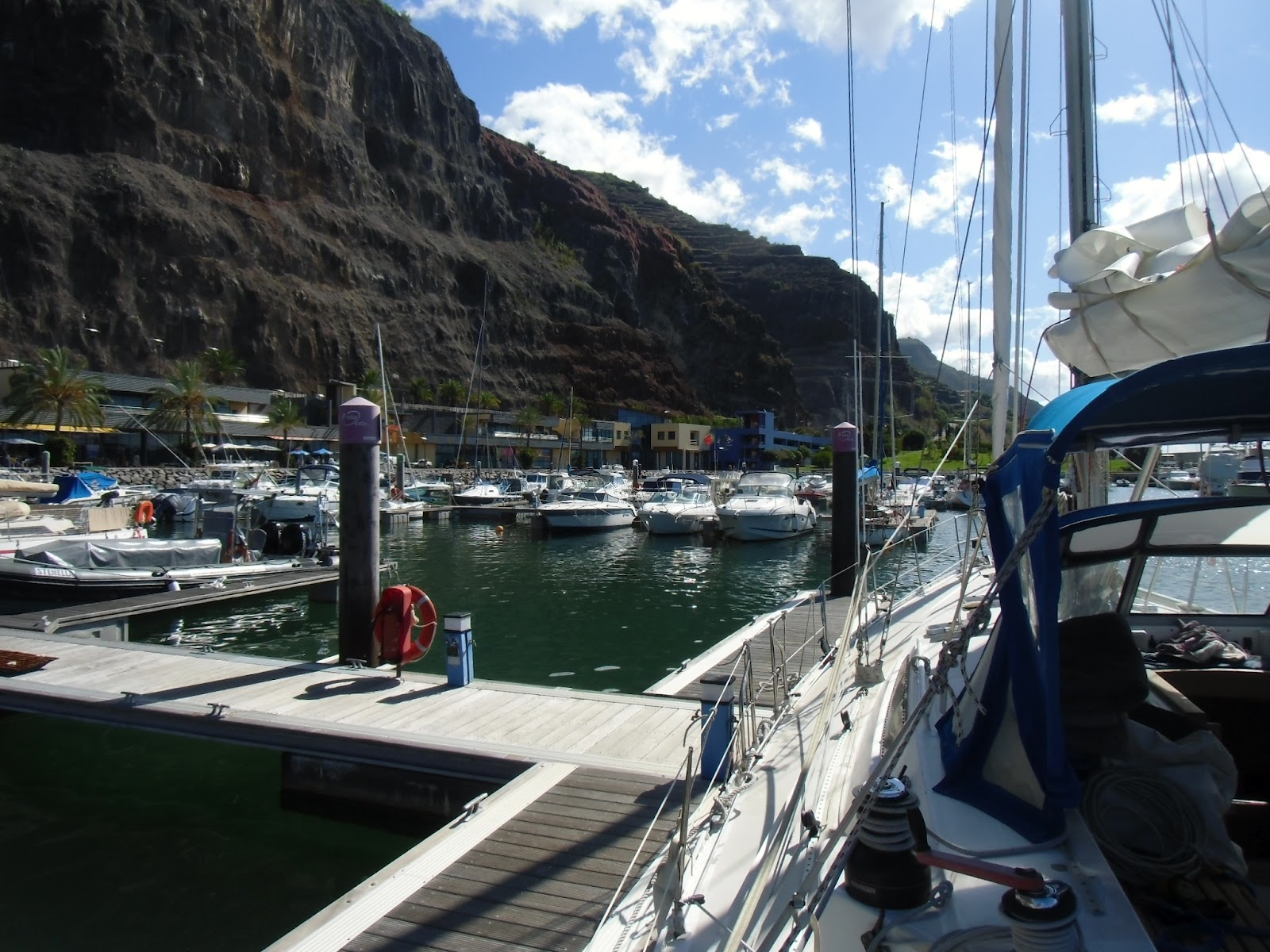
View of the Calhete marina in the distance with the protected swimming area in the foreground - had several very pleasant swims there so far

No comments:
Post a Comment