Caught the 13.15hrs bus from close to the Tourist office above the marina in Horta direction Capelinhos at the western tip of Faial.
Around 13.50hrs we started our hike, PR1FAI , from the cross roads at Cruzeiro, near Capelo
After a five minute walk up the road towards Praia do Norte, we turn left to the official start of the hike
The route takes us over the rims of two caldeiras and ends at the disused lighthouse at Capelinhos
The first part of the hike was steeply up a tarmac road, lined in many places with a colourful display of Hydrangeas, Ginger Lilies
and Montbrecias
by 1500 hrs were were at the rim of the 487 meter high Cabeco da Fonte crater, with its communication towers
and good views to the north
and the distinctive Morro de Castelo Branco peninsular in the distance on the south coast
Capelinhos to the west
zooming in to the Ponta dos Capelinhos lighthouse
looking east to Faial's main central Caldeira
the north coast
down the steep steps to our next objective, the Cabeco do Canto crater
through some woods
another glimpse of the lighthouse
starting the ascent to the Cabeco do Canto crater
made it to the crater rim, covered in stunted Tree Heather
view of the crater
Looking back east to the Cabeco da Fonte crater which we have just descended
zooming in to the Furna Ruim , a sort of large fumerole in the side of the volcano
zooming in to the Morro de Castelo Branco
getting closer to the disused lighthouse
zooming in
and in
The official track is described as returning via the col between the two Cabecos.
However, there is a marked route which continues westwards
a short detour
to the cave
looking back to the Cabeco do Canto
our route continues downwards
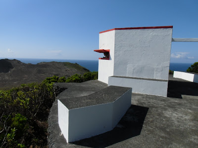
an old whaling observation point
Whale ..........
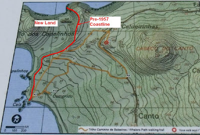
Before the 1957 eruption, there was a small village here and a whaling harbour. Now the village is buried below the ash - another Pompei?
another detour - to the original cliffs pre 1957
over the volcanic ash
From the cliff top, views of the new land which was formed in 13 months during the volcanic eruption which started on 27th September 1957
During this 13 months the whole island suffered earthquakes (El Hiero the most SW Canary Islands must have been experiencing something similar over the last year). As a result, many people emmigrated from the island.
The original coastline cliffs looking towards the lighthouse
looking back to Cabeco do Cante
great place for a break
A clearer view of the new land extension
Since the 1957 eruption, the Ponta dos Capelinhos lighthouse has no longer been used. Mainly because the new land formed to the west severely restricts the angle from which the light can be seen. The story goes that the lighthouse keeper stayed by his lighthouse while the initially subsea eruptions were taking place.
At 1830 telephoned for a taxi which arrived 25 minutes later and we were back on Dutch Link by 1930hrs.


